Geographical Information System


- Our maps on Hungary
- Databases generated from our Hungarian maps
- Formats of our maps on Hungary
- Lawfulness
- Our GIS maps on Slovakia
- Formats of our maps on Slovakia
- Our maps on Europe
- Projections and data formats of our maps
- Prices of our GIS maps
Our maps on Hungary
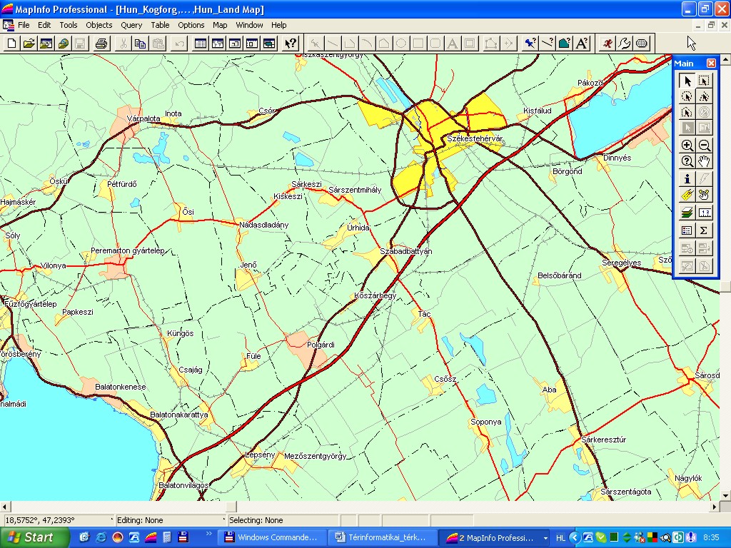
Hungary’s settlement level GIS map of a resolution that corresponds to the scale of1:100,000
Planimetric content:
- the border line of the country, the statistical regions, the counties and the outskirts of the settlements
- contours of the built-in areas of the county seats, cities and settlements
- hydrographs with lakes and rivers, with a content that corresponds to the resolution of the maps
- the national railway network
- the national public road network broken down to five levels, from which the first two levels include the motorways and the main transport roads, and the next three levels contain the byroads broken down by their importance, the motorway entry sliproads and the roundabouts
Data content:
- the names of the country, of the statistical regions, and of the counties are allocated to their border lines
- in the case of the built-in area contours of the county seats, cities and settlements, their names, Central Statistical Office code, postal codes and the number of the population that lives in the given settlement or settlements section was allocated as relevant data
- to the hydrographical elements we allocated their names and in the lack of this the lake and river category
- we allocated to the first two levels of the road network their numbers and names, and the remaining three levels of roads carry the categories ’byroad1’, ‘byroad2’ and ‘byroad 3’ as their attributes.
View sample »
Demo download (1 MB) »
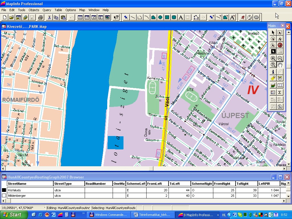
The built-in area, street level, street corner house number containing map of Budapest of the scale of 1:10,000
Planimetric content:
- name labels of agglomerations, landscape units, waters, railways, pass-through roads, outbound roads, city sections, spectacles, cemeteries, streets, districts.
- graphic objects of motorways, express roads, pass-through roads, main roads, roads, small roads, pedestrian streets, squares.
- lines of chairlift, cogwheel tram and railway network, lines of the suburban railways (HÉV), metro, tram, bus and trolleybus routes.
- border lines of the city border and the city sections, graphic objects of the districts, lakes, rivers, forests, parks, plough-lands, sport fields, special buildings, cemeteries
Data content:
Data that are connected to the street centre line sections: name and type of public territory, number of public road, in the case of cities data concerning one way traffic and traffic allowed, attributes of the increasing of the right and left side house numbering, data of the block corner house numbers of the right side and the left side, county, settlement, city section and district information, length of the graph edge.
View sample »
Demo download (E, F, G formats – 2,6 MB) »
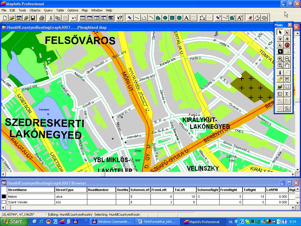
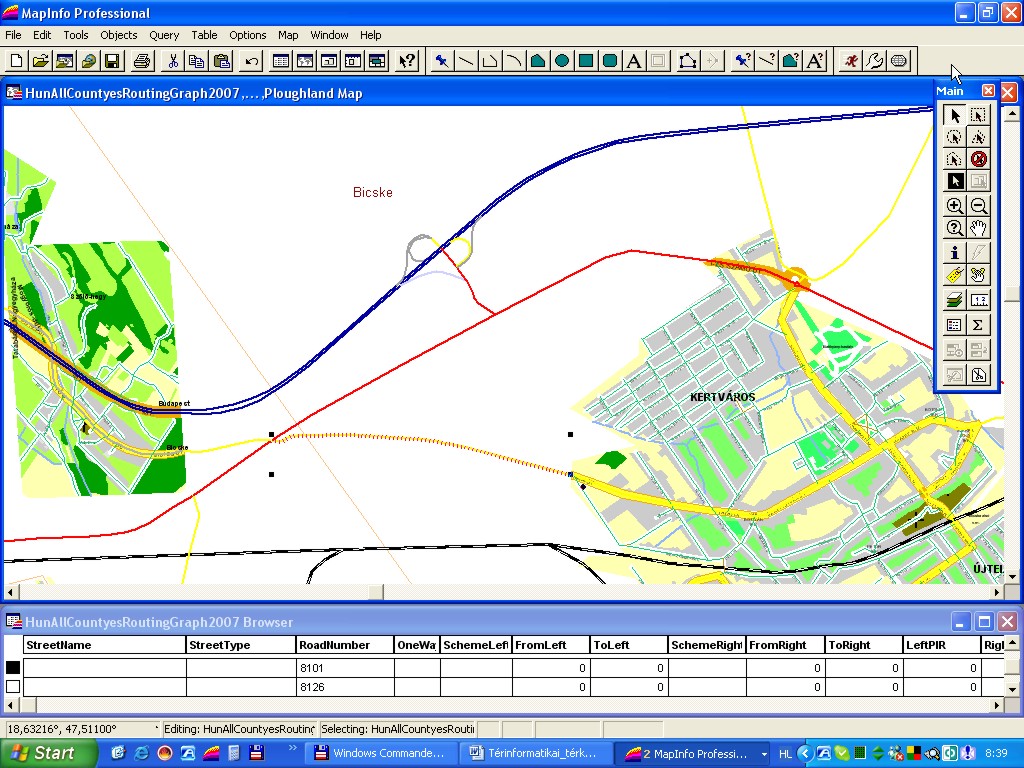
The built-in, street level, street corner house number containing map of all the settlements (about 3150) of Hungary of a scale of 1:10,000 and their routing graph database
Planimetric content:
The graphic objects of plough-lands, fields/grasslands, gardens, farmlands, forests, built-in areas, reed-lands, cemeteries, special buildings, parks, rivers, lakes, the streets, roads and the labels of the national road network, railway network, waters, squares, streets, roads, city sections, outbound road directions, and the other items.
Data content:
Data that are connected to the street centre line sections: name and type of public territory, number of public road, in the case of cities data concerning one way traffic and traffic allowed, attributes of the increasing of the right and left side house numbering, data of the block corner house numbers of the right side and the left side, county, settlement, city section and district information, length of the graph edge.
View sample »
Demo download (A, B, C, D formats – 10 MB) »
Demo download (E, F, G, H formats – ? MB) »
The national public road network had been integrated with the street network graph on the basis of nodes; therefore with the aid of our database it is possible to prepare routings as well.
Fontos információk